WHO WE ARE
Welcome to Big Sky Aerial Solutions. We help utilities, AEC teams, and land surveying professionals capture accurate data and turn it into clear, actionable geospatial deliverables. Our primary objective is to improve decision-making through high-quality LiDAR, photogrammetry, and inspection workflows that reduce field time, increase safety, and support faster planning and asset documentation. Every project is delivered with practical outputs that integrate into GIS and engineering workflows, making data easy to review, share, and use.
Trusted By


BVLOS-Capable Flight Operations
2000+ miles flown in 2025
Serving Clients Across the US and Canada
WORKFLOW
HOW WE DO IT
Inquire
Meet
Collaborate
Design Scope
Collect
Coordinate
Mission
Verify
Deliver
Process
Analyze
Deliver
CLIENT PORTAL
Access project deliverables anytime through a simple, secure client portal built for utility, AEC, and surveying workflows. View project status, review files, and download GIS-ready data, reports, and imagery in one easy location—no complicated steps.
Your data stays protected with encrypted storage and controlled access, giving your team a reliable way to share, review, and manage deliverables with confidence.
INCLUDES
2 Factor Authentication
Encrypted using AES 256-bit
Transmitted securely using TLSv1
Data storage redundancy
INDUSTRIES

POWER UTILITY
We deliver utility aerial inspection and LiDAR mapping solutions that help electric utilities and cooperatives improve grid reliability, reduce wildfire and vegetation risk, and increase field efficiency. Our solutions include drone-based RGB and thermal inspections for distribution, transmission, and substations, LiDAR corridor mapping for clearance analysis and PLS-CADD-ready engineering deliverables, and GIS-integrated vegetation management to support defensible, risk-based maintenance planning. We also provide 3D substation modeling, storm response damage assessments, and INSPECTR, a web-based platform that streamlines inspection reporting, asset documentation, and geospatial data review for utility operations and engineering teams.

ENGINEERING & SURVEYING
LiDAR and photogrammetry provide survey-grade mapping deliverables for land surveyors, civil engineers, and construction teams, including topographic mapping, high-resolution orthomosaics, planimetric feature extraction, custom LiDAR classifications, stockpile volume calculations, and digital surface models (DSM/DTM). These outputs support existing conditions, greenfield design, redevelopment, construction planning, and as-built documentation by delivering accurate, measurable site data for CAD and GIS workflows.

ARCHITECTURE
Our Scan-to-BIM services provide architecture teams with accurate existing conditions using interior and exterior LiDAR reality capture. We deliver high-density point clouds, 3D models, and BIM-ready outputs to support renovation design, retrofit planning, and as-built documentation. These Scan-to-BIM deliverables improve VDC/BIM coordination, clash detection, and project collaboration by providing a precise, measurable model of the built environment—reducing site visits, minimizing rework, and keeping design and construction schedules on track.

MINING
LiDAR and photogrammetry provide survey-grade mapping deliverables for mining operations, including topographic surveys, high-resolution orthomosaics, digital surface models (DSM/DTM), and volume calculations for stockpiles, pits, and site infrastructure. These datasets support mine planning, haul road design, reclamation, and accurate existing conditions documentation for engineering and compliance workflows. For remote or hazardous sites, aerial water sampling enables environmental monitoring and sample collection in inaccessible locations while reducing risk and limiting personnel exposure.
DELIVERABLES

AERIAL INSPECTION & REVIEW
Inspection deliverables include drone-based RGB and thermal inspection imagery for distribution, transmission, and substation assets, with component-level findings reviewed, severity-ranked, and documented to support utility maintenance planning. Results are delivered through GIS-integrated inspection maps and reports, with optional web-based inspection review and repair tracking in INSPECTR to streamline utility workflows and compliance documentation.
INCLUDES
Distribution Poles
Transmission Towers
Right of Way
Substations
METHODS
FILE TYPES
PDF, JPEG, RJPG
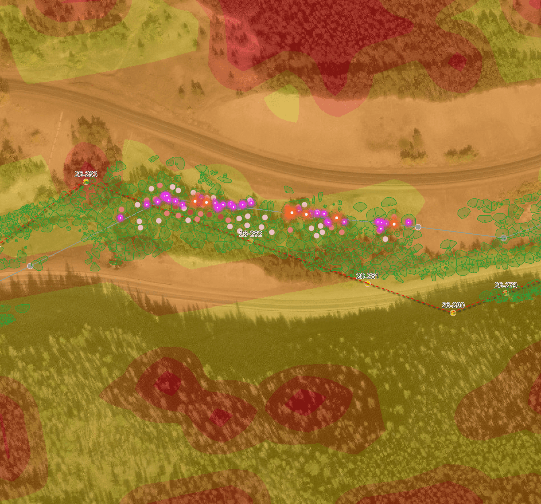
VEGETATION & WILDFIRE RISK INTELLIGENCE
Vegetation and wildfire risk intelligence deliverables use LiDAR-based analysis to deliver true-to-life right-of-way visibility that is more accurate and actionable than satellite-only screening. Outputs include danger tree identification, vegetation encroachment severity ranking, and GIS-integrated mapping that shows where vegetation and utility infrastructure intersect with elevated wildfire risk. Results are delivered as map-based hazard reporting and field-ready layers that support defensible wildfire mitigation and prioritized maintenance.
INCLUDES
Danger Tree Identification
GIS Mapping Interface
Encroachment Severity
Hazard Reporting
True-to-Life Data
METHODS
FILE TYPES
SHP, geoTIFF, KML, PDF

JOINT USE AUDIT & DESIGN
Deliverables include PLS-CADD-ready LiDAR point clouds, high-resolution imagery, and GIS-ready maps to document pole attachments, clearances, and conflicts. Outputs also include feature extraction, attachment inventories, and make-ready support tailored to utility compliance and engineering workflows. Results are delivered in utility-friendly formats that streamline review, improve coordination with attachers, and support defensible decision-making.
INCLUDES
PLS-CADD
Custom Classification
Asset Inventories
Clearance Analysis
Contours
Color Point Clouds
DEM, DSM, DTM
Design Plan Overlay
METHODS
FILE TYPES
LAS, LAZ, DWG, SHP, TIFF, DEM, And more...
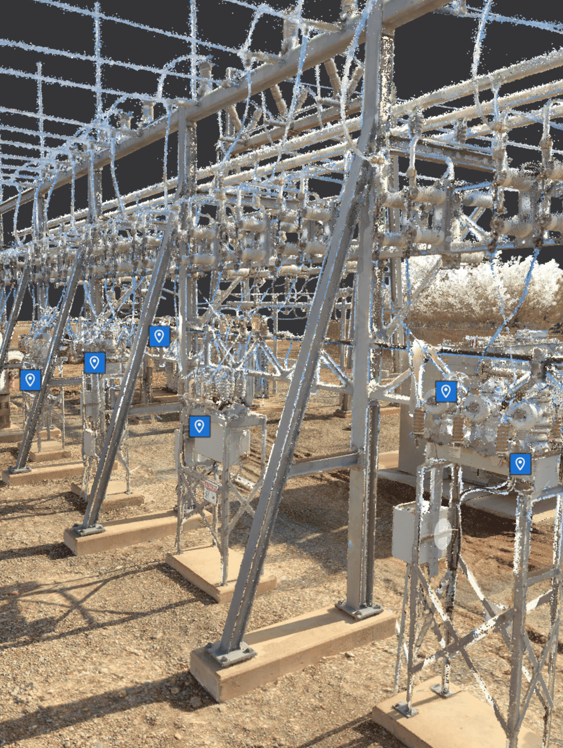
SUBSTATION AND FACILITY MODELING
Capture a reliable 3D substation and facility model using advanced aerial data capture and terrestrial scanning. These substation modeling deliverables provide accurate existing-conditions documentation to support planning, upgrades, and expansions—especially when as-builts are missing or outdated. Models are delivered through a web-hosted interface and easily integrate with utility engineering tools to improve coordination across engineering, operations, and management.
INCLUDES
As-builts
POIs
Existing-conditions
Web-Hosted
Point Clouds
METHODS
FILE TYPES
LAS, LAZ, e57, PLY, And more...
MAPPING
Accurate mapping deliverables provide clear, survey-grade insight into existing ground surface conditions and existing site conditions for planning and design. Data collection is completed under the supervision of a licensed Professional Land Surveyor (RPLS) to ensure verified accuracy and legally defensible results.
INCLUDES
Contours
DEM, DSM, DTM
Orthomosaics
Hydro-flattening
3D Textured Mesh
Classifications
Breaklines
Stockpile Analysis
Design Plan Overlay
Color Point Clouds
METHODS
FILE TYPES
DEM, DXF, KML, LAS, LAZ, SHP, XYZ, SHX
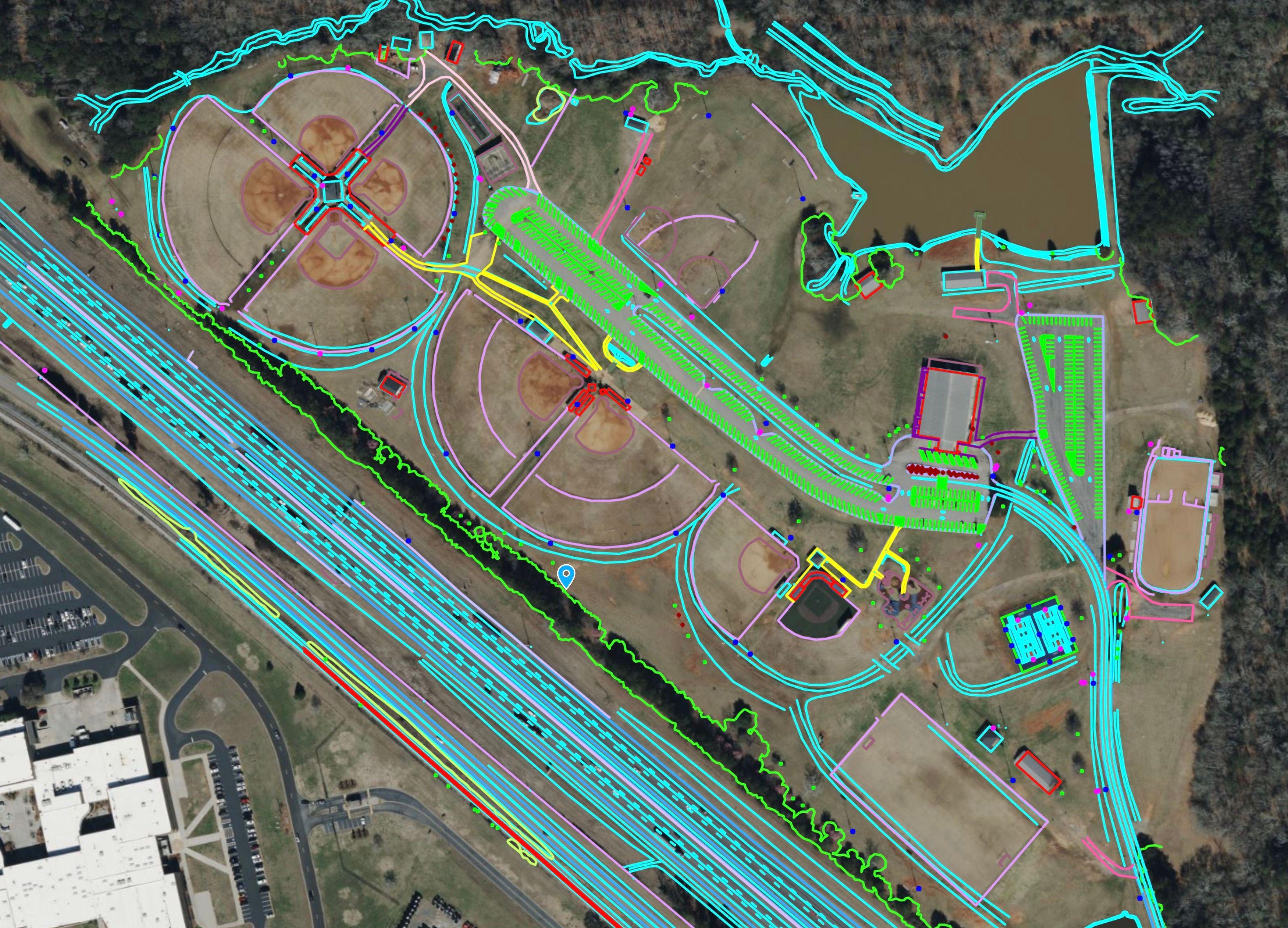
PLANIMETRICS
Planimetric deliverables include detailed vector linework and feature extraction to support mapping, design, and engineering workflows. Outputs are delivered in CAD-ready formats for efficient review, planning, and coordination across project teams.
INCLUDES
Fences
Pavement
Concrete
Docks
Buildings
Roads
Manholes
Powerlines
Curbs
Gutters
Sidewalks
Water Surfaces
Railroad Tracks
Treeline
Drains
And more...
METHODS
FILE TYPES
DWG, SHP, DXF
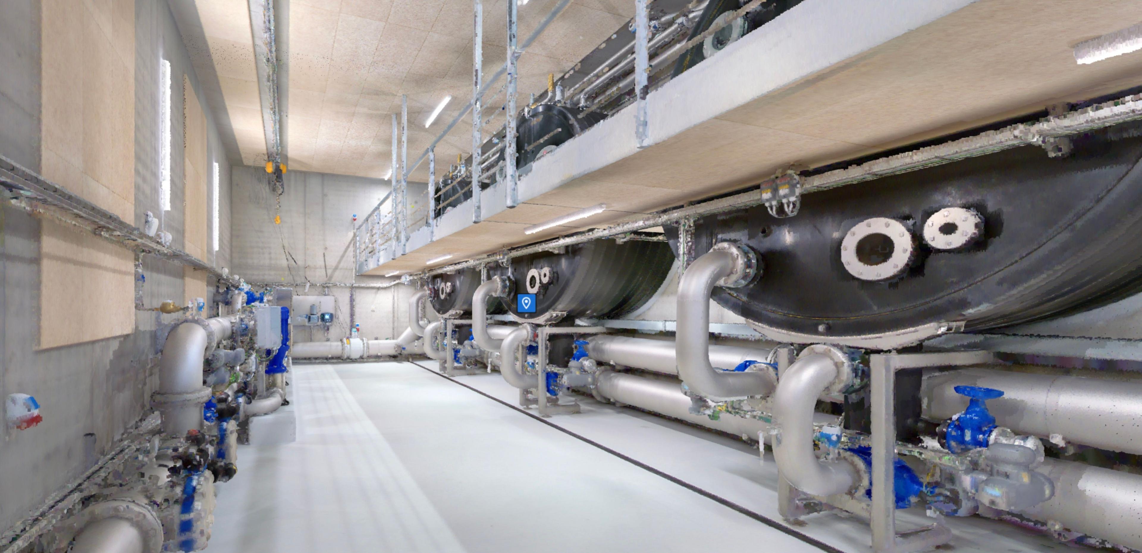
DIGITAL TWIN
Build a detailed 3D digital twin from interior and exterior point clouds to provide accurate existing-conditions documentation, support engineering workflows, and improve facility planning.
INCLUDES
SLAM
Point Clouds
Scan to BIM
BIM
Feature Classes
Design Overlays
VDC
POIs
METHODS
FILE TYPES
LAS, LAZ, e57, JPEG, PLY
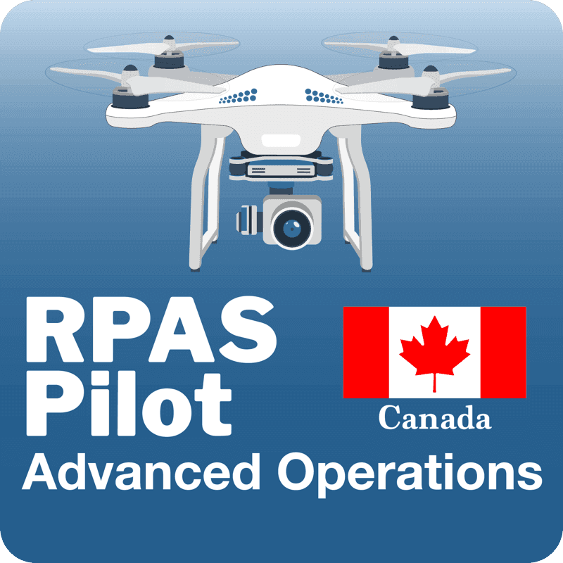
BVLOS
Beyond Visual Line Of Sight
BVLOS capability supports efficient collection, rapid mobilization, and reduced field exposure—while maintaining safe, compliant operations. In 2026, we will continue expanding waiver capabilities across sUAS platforms and operating scenarios to support scalable utility and mapping missions.
Current Operational Waivers Held:
Waiver #107W-2023-03494 for BVLOS operations with no VO in Class G airspace.
Waiver #107W-2024-00334 for shielded BVLOS operations with no VO on all linear infrastructure in Class G airspace throughout the US for multiple aircraft types.

CONTACT
CONTACT
REACH OUT
Fill out the form below to tell us about your project. Our team will follow up within 24 hours.